To increase the environmental impact of a carbon project, the Gold Standard requires each project to define a conservation perimeter equivalent to 10% of the project area. This area must be protected from any exploitation activity and is not eligible to receive income from carbon credits. It is truly a perimeter dedicated to biodiversity.
This is easier said than done, because in the case of arboRise it means finding more than 180 hectares for each cycle of 1,500 hectares. Fortunately, the communities we work with are very interested in preserving their environment. They know exactly which areas of the village are important. These include
- the spring heads (where water gushes out of the ground), which are very fragile and vital for providing the water needed in the village: for cooking, for market gardening, for cleaning, etc.
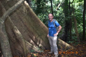
- sacred forests, which often surround the villages and into which it is forbidden to penetrate under threat of very serious trouble. These remnants of primary forest are real reservoirs of biodiversity, providing food for animals and seeds for the surrounding area. These forests are also under threat as modernity replaces ancestral traditions.
- groves where the ritual initiations of young men and women take place.
- wetlands: streams, marshes, low-lying areas, etc. that are often home to wildlife.
These sensitive and precious areas are currently only protected by tradition and its guardians. Under the Forestry Code, the Guinean government provides support for communities wishing to protect certain areas. It is possible to put these areas under protection, which legally protects them for 99 years. In practical terms, this means that these areas are now also under the protection of the State, represented by the Water and Forestry Department of the Ministry of the Environment and Sustainable Development. Penalties are provided for anyone guilty of damaging these protected areas.
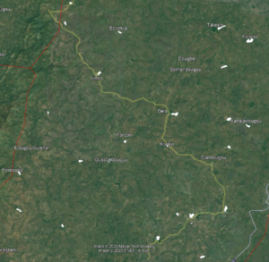
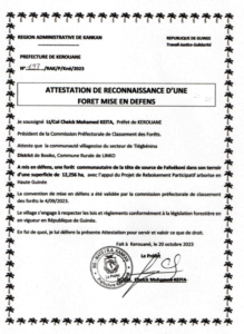
Each village deliberated to identify the area or areas to be protected, usually sacred forests. These areas were then geo-referenced by our partner GUIDRE, whose director is regional manager of the ICCA consortium. Each village made an official request to the Water and Forestry Department for the areas to be set aside, and finally the Prefect of Kérouané signed the 25 certificates for the areas to be set aside, covering a total area of almost 200 hectares, thus protecting them from anthropic pressure.
Map of conservation areas: A prefectoral certificate: