
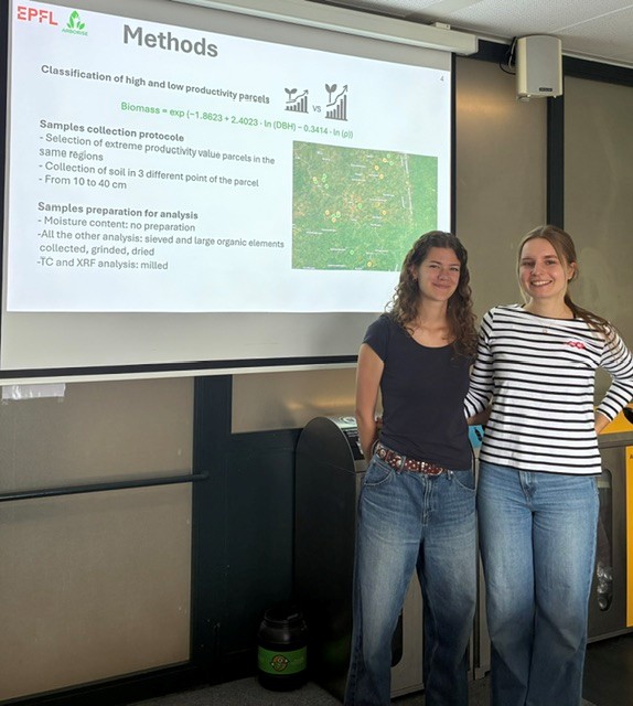
We have known that the soil has a significant influence on the growth of our trees since Ines and Aurèle’s Design Project 2024. We wanted to find out more as part of a new Design Project with EPFL. Camille Perrin and Alena Vasilyeva analysed soil samples taken from 19 sites: 10 sites where our trees are growing strongly according to our dendrometric measurements, and 9 sites where our trees are not growing well. Alena and Camille show that two groups of factors explain our trees’ growth and that pH is a key determinant. The more acidic the soil, the less accessible the nutrients present in it are to plants (paradoxically, there is more phosphorus in the soil of the underperforming plots, as this phosphorus cannot be absorbed by the trees because it is more strongly bound to other atoms). In temperate zones, liming is used to make the soil more
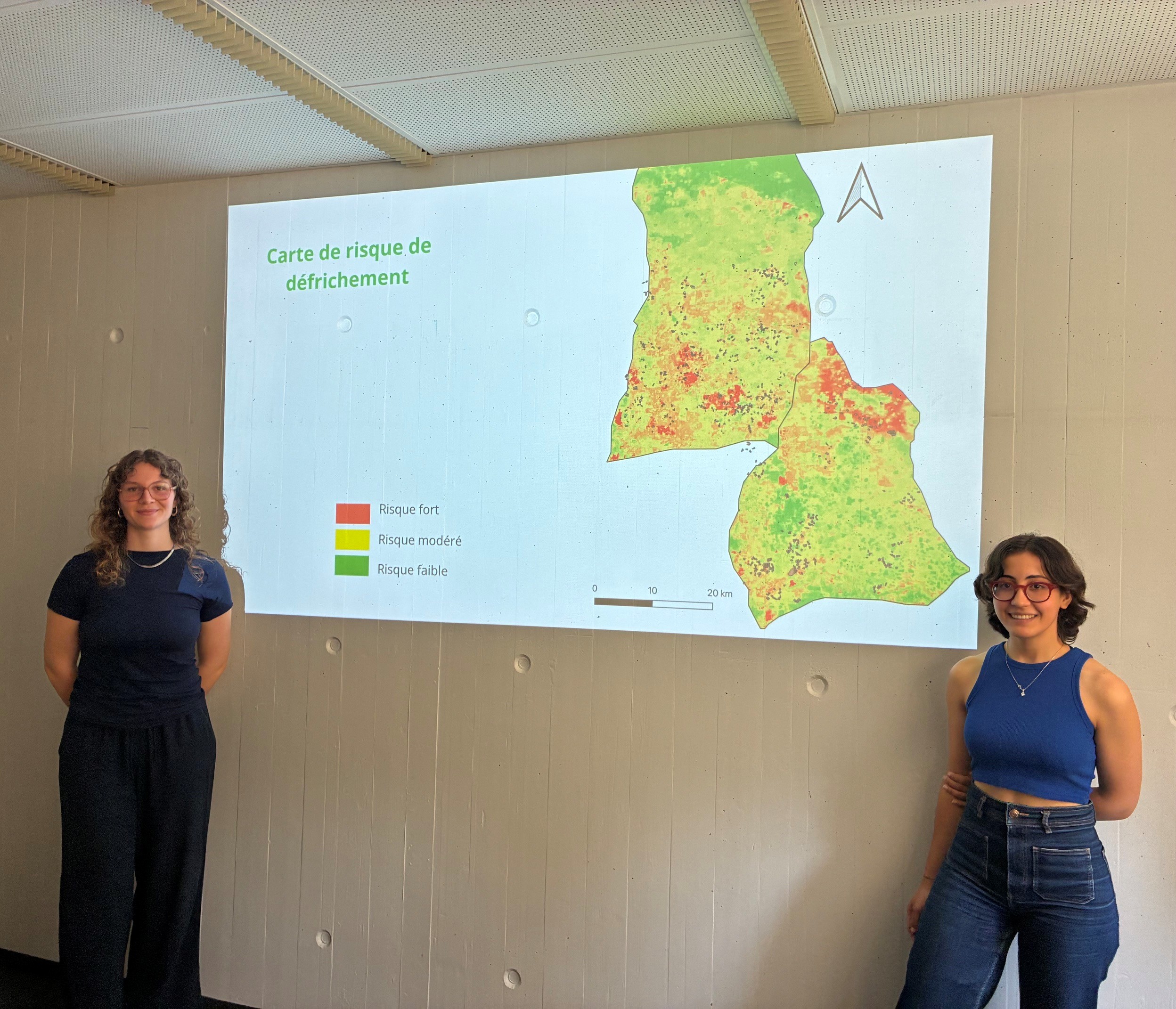
Predicting land clearing is important for our project. That is why, once again this year, we have collaborated with EPFL as part of a Design Project. Feryel El Phil and Camille Dupré Tabti first demonstrated that the first derivative of NDVI values is a good method for identifying when land is being cleared. This enables them to calculate the crop rotation cycle for each plot of land. As can be seen below, this varies considerably: some plots have a rotation cycle of 7 years (roughly 2 years of cultivation, 5 years of fallow), whilst others can be as long as 25 years: Building on these findings, they then produced a map showing the probability of land clearing in Linko and Samana and concluded that the risk of our plots being cleared increases if the land is easily accessible to farmers (close to the village) and if it is naturally fertile.
As we recall, in 2025 the land-owning families had agreed to allocate 10 per cent of their ‘carbon income’ to their village. The amount was distributed in proportion to the number of land-owning families and the area of land reforested by each village. Thus, Forono, the largest village, received around CHF 800, whilst Kala, the smallest village, received CHF 50. As these sums were insufficient for genuine infrastructure works, they were spent without any lasting impact. We wanted to change this and proposed that the cooperative’s committee consider the matter. The idea was to no longer distribute the annual CHF 10,000 from the ‘villages’ share’ amongst all 26 villages, but only to two villages each year. The amounts would then be sufficient to build sustainable infrastructure. The cooperative committee approved the idea and put it forward to the Cooperative’s General Assembly, suggesting that the two beneficiary villages be chosen by
The end of March was spent preparing for the verification audit. Around thirty plots were initially selected at random. Of these, the auditors check half, generally based on the stratum. For example, three plots sown in 2021, four from 2022, three from 2023, and so on. To ensure the site visit programme can be completed within a few days, it is also important to check that each plot is accessible. On the selected plots, our partners at South Pole insisted that the GUIDRE teams repeat the tree measurements taken in November, to be absolutely certain of avoiding any unpleasant surprises. The tree measurements taken in the presence of the auditors must correspond exactly to those taken before the audit. There is no room for error. Yet surprises cannot be ruled out: traces of past fires or livestock grazing, a baseline tree that has been ‘overlooked’ or ‘added’… several issues that
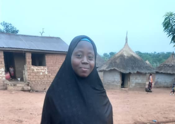
Mariame Condé has been a ‘seed family’ in the village of Kofilakoro since January 2022. She harvests the Carapa procera (Kobi) species. Let’s hear her describe her experiences in her mother tongue, Konianke, translated by Sékouba Condé, one of the supervisors at our partner organisation GUIDRE: My name is Mariame Condé, a seed family. This project has changed my life. In 2022, I was pregnant and collected 20,000 seeds. The project paid me 1,000,000 GNF, which was a relief. At the time, my husband had gone to Sigiri, a mining area, to search for gold, and our harvest was almost gone. I used the money from Arborise to buy food and clothes for my son. In 2023, I received 1,000,000 GNF and bought two sheep. I also got a large tarp that makes collecting seeds easier. After the seed harvest, I used the tarp to dry my rice and for
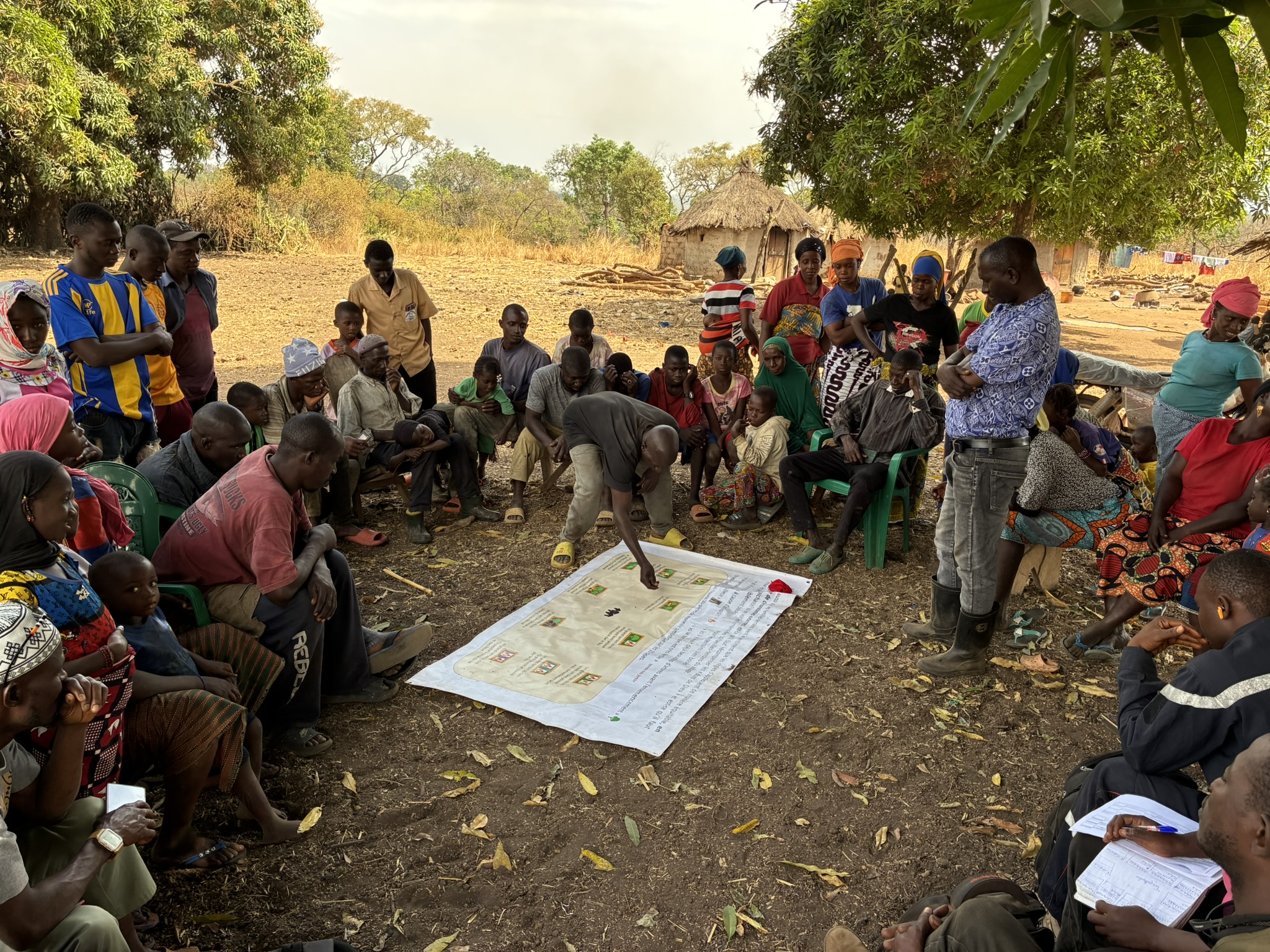
One of the Cooperative’s objectives, and the main role of the Cooperative Committee, is to develop a carbon revenue sharing formula. Indeed, it is certainly not up to arboRise to define how these revenues will be shared among the cooperative members. This choice must be made by those most directly concerned, based on local traditions and customs. But what will these criteria be? And how should they be weighted? Should effort and merit be taken into account, or should revenues be distributed evenly? Can fate be invoked to justify certain disappointing results? Etc. Rather than discussing these criteria in the abstract, we opted for serious games, which are more effective. In concrete terms, we used pre-printed tarpaulins showing several scenarios, such as this one, where the aim was to distribute income according to the hazards suffered by landowners: Each member of the cooperative committee had 20 (symbolic) coins representing the
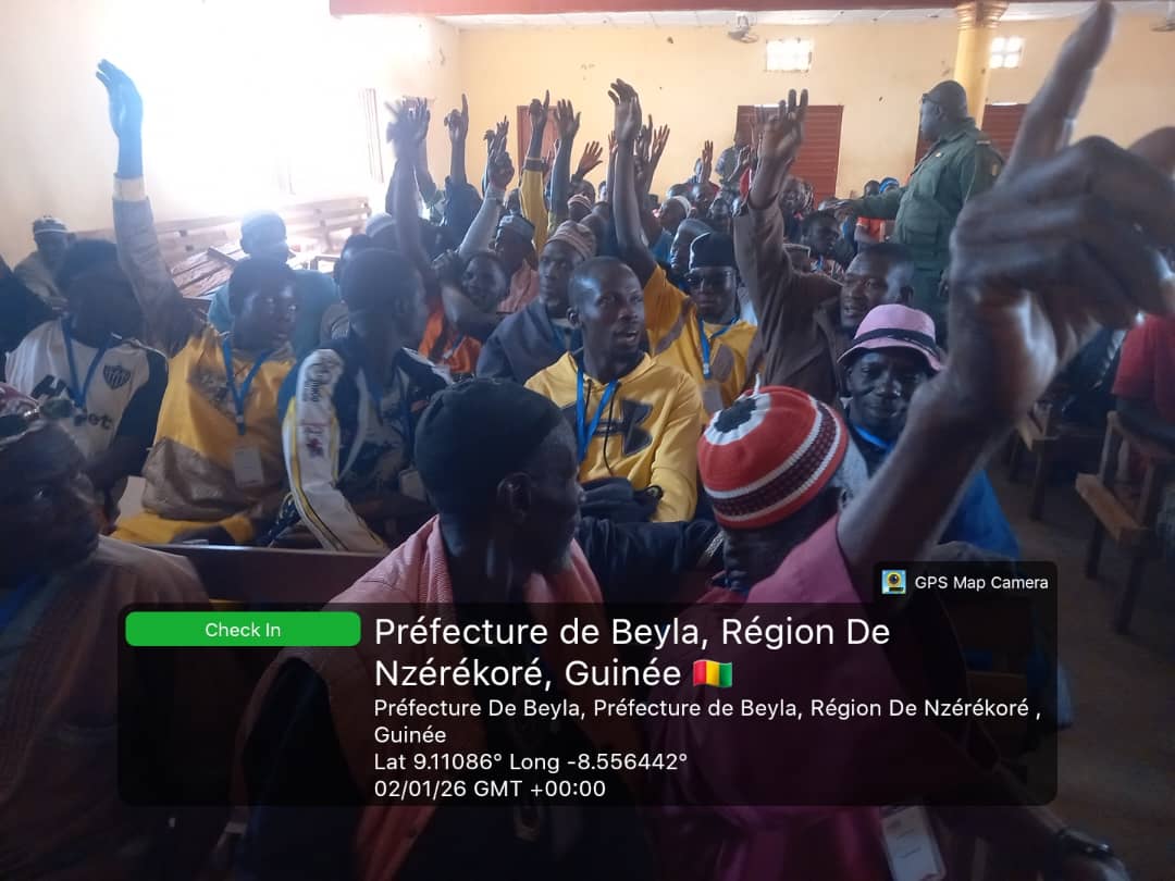
In December 2025, we founded the Samana Family Land Cooperative to properly manage the common good that is the new arboRise forests (see our report here), and on 1 February 2026, a new General Assembly was held to elect the cooperative’s governing bodies: In preparation for the election of the 18 members of the Cooperative Committee, each village had previously elected two representatives, one man and one woman. At the general meeting, we simply used a hat in which we placed 10 ‘Woman’ tickets and 8 ‘Man’ tickets. Each village drew a slip at random, and that is how we ended up with a Cooperative Committee made up mostly of women, all of whom are well known in their villages and therefore visible at the sub-prefecture level. —- In this regard, some circles readily express sympathy for the plight of African women. For our part, we see tangible signs of